Wollondilly Emergency Dashboard
Wollondilly Shire is located in the southwest of Sydney, Australia, with a population of approximately 50,000. It is renowned for its beautiful natural landscapes and proximity to the Blue Mountains. Despite the area's picturesque scenery, Wollondilly is also at risk of natural disasters such as floods, bushfires, and storms. In recent years, the region has experienced several flooding events, with rising water levels in multiple areas forcing residents and emergency services to evacuate.
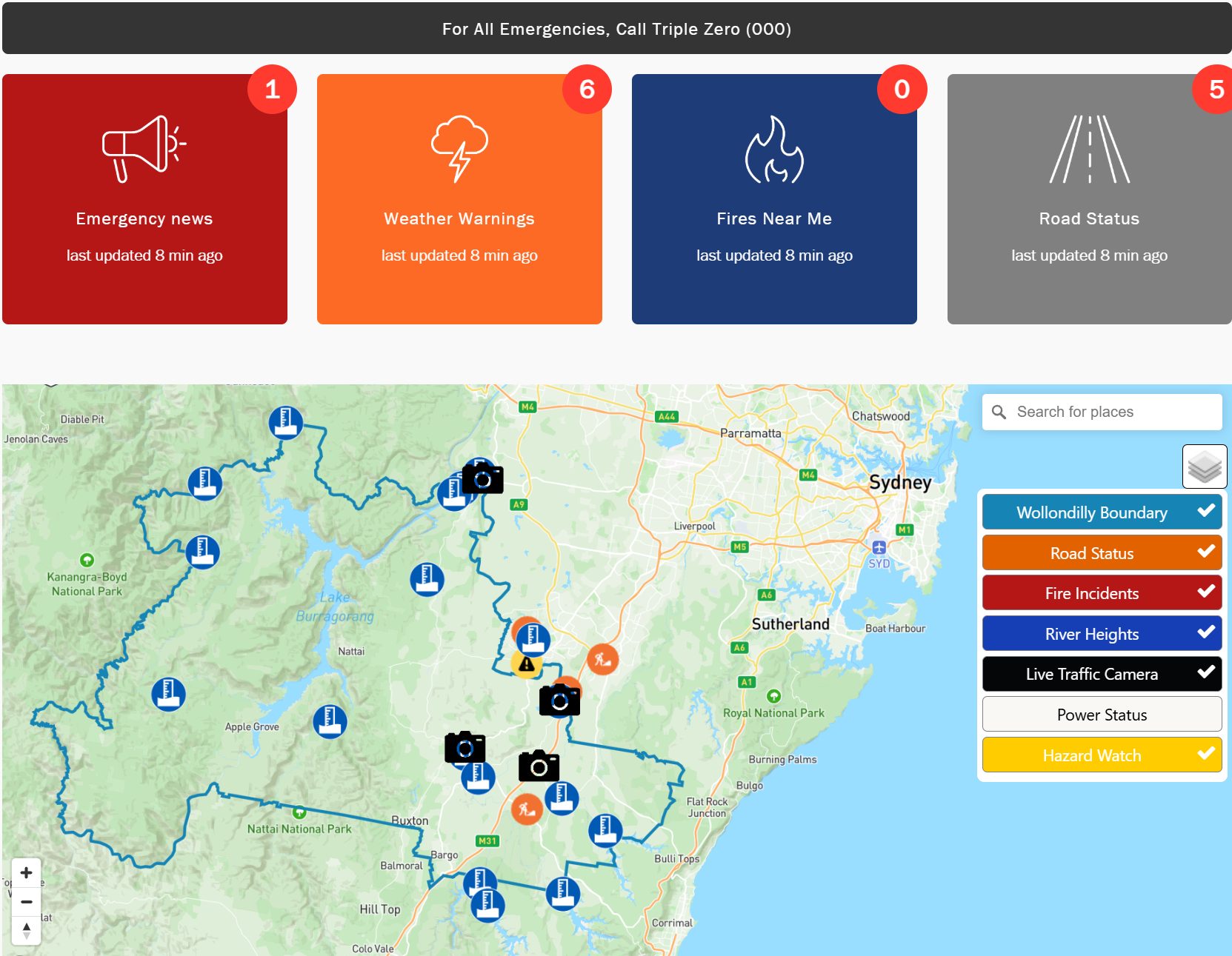
In response to these disaster risks and to enhance the community's disaster preparedness, the Wollondilly Shire Council recently launched the Wollondilly Emergency Dashboard. The goal of the platform is clear: Stay Informed. Stay Prepared. Stay Safe. By providing real-time emergency information, the dashboard ensures that residents and emergency services can receive the latest alerts and key data during a disaster, allowing them to take swift and effective action to ensure community safety.
Enhancing Wollondilly's Emergency Data Management
Wollondilly Shire Council and Peclet have worked collaboratively in shaping the Wollondilly Emergency Dashboard, leveraging advanced technology to enhance the region's emergency data visualisation capabilities. By integrating multiple trusted data sources into a seamless platform, the dashboard enables both the community and emergency services to access critical information instantly, allowing for swift and coordinated action. This ensures that the public receives timely alerts, road status updates, and fire warnings.
Wollondilly Shire Council's Community Resilience and Recovery Officer, Vickie Tierney, praised the dashboard's impact on disaster preparedness:
"This platform is designed with one goal in mind: keeping the Wollondilly community informed, prepared, and safe. It serves as a single source of truth, providing real-time information to residents by integrating data from a variety of trusted sources including Transport for NSW, Hazards Near Me, Fires Near Me, BOM, and Council alerts."
Dashboard Features:
-
Emergency News and Weather Warnings
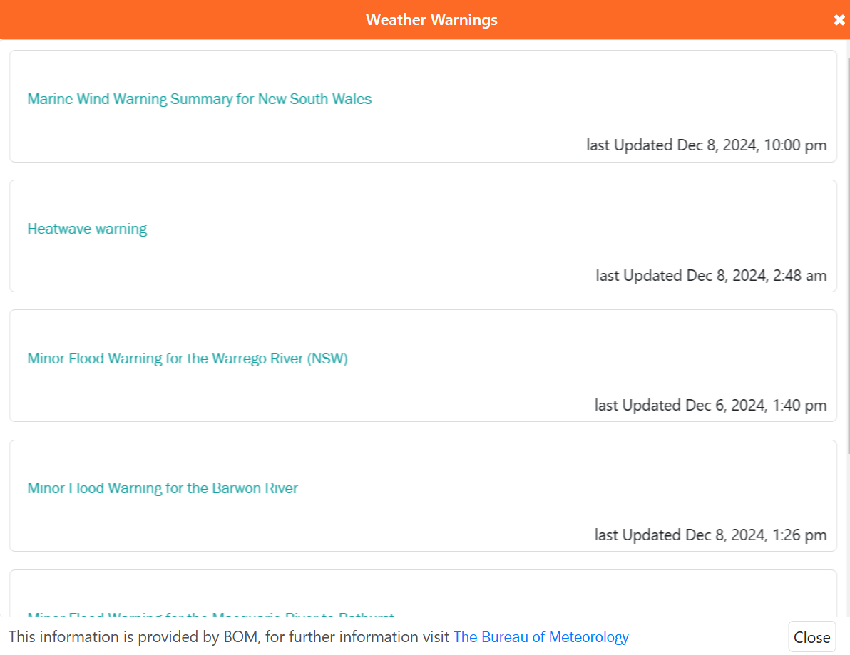
Provides real-time updates on important disaster alerts, including fires, floods, storms, and heatwaves, helping residents stay informed about the latest disaster information. For example, updates on minor flood warnings and heatwave alerts help residents respond to warnings effectively.
-
Road Status and Fire Information
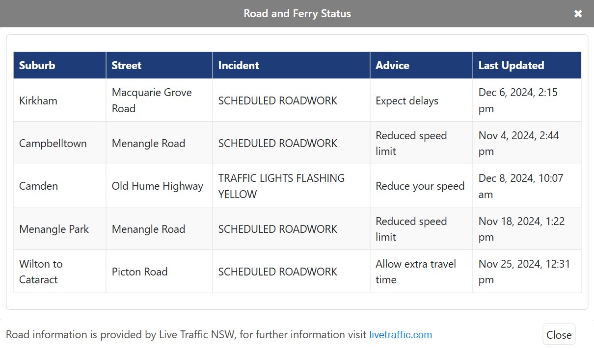
Offers real-time road status, including speed limits, construction updates, and traffic incident notifications. It also displays the location, spread, and danger level of fires, enabling emergency services to assess the situation quickly and make informed decisions.
-
River Heights and Power Status
To manage flood risks, the dashboard provides real-time river height data to help predict floods and ensure timely responses. Additionally, power outages are common during disasters, and the dashboard provides real-time power status updates, helping residents prepare for emergencies.
-
Neighbourhood Safer Places
In times of disaster, finding a safe place is crucial. The dashboard provides the locations of nearby safer places, helping residents quickly find shelter during emergencies.
-
Access to Additional Emergency Resources
The dashboard provides real-time disaster updates while also connecting residents to a range of additional resources. These include relevant websites, social media channels, and radio stations, such as the Bureau of Meteorology (BOM), NSW State Emergency Service (SES), ABC Radio Sydney, among others.
These trusted platforms ensure residents can access comprehensive information on weather conditions, emergency alerts, and recovery support when it's needed most.
Improving Accessibility with Digital Displays
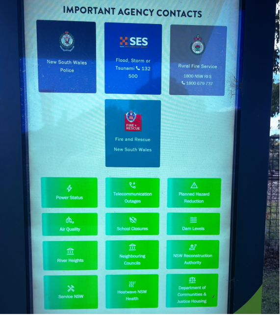
To address situations where personal devices or internet access may be unavailable during emergencies, Wollondilly Shire Council has deployed Digital E-Kiosks in key community locations, including Oakdale, Warragamba, and Bargo. These displays ensure that the emergency dashboard remains accessible to everyone, providing critical information when it's needed most.
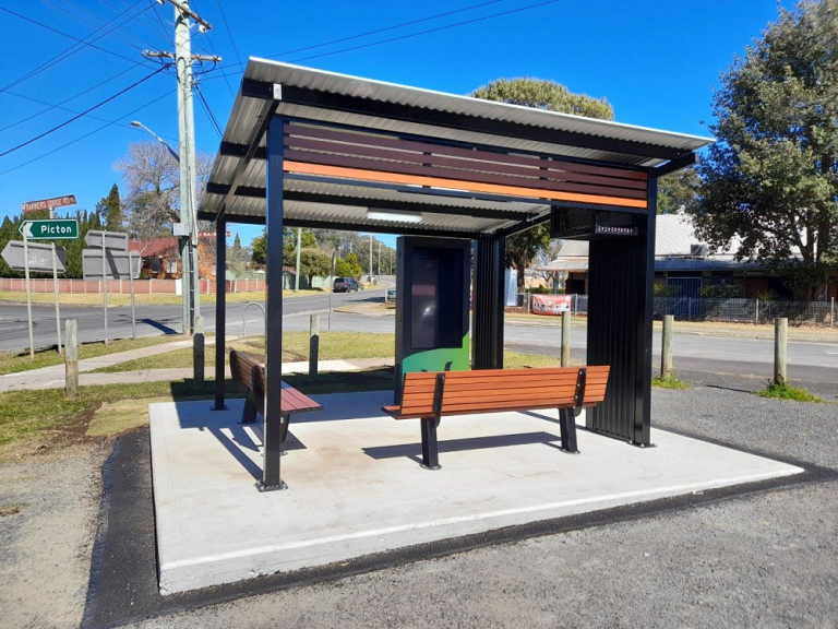
The digital displays offer direct access to the dashboard, enabling residents to stay updated on fires, floods, road closures, and weather warnings. They also include additional features such as public WiFi and USB charging facilities, supporting the community during emergencies.
Supporting Community Resilience
The launch of the Wollondilly Emergency Dashboard reflects Wollondilly Shire Council's commitment to community safety and disaster preparedness. It also highlights Peclet's expertise in delivering innovative, data-driven solutions. By providing real-time information and improving accessibility through digital displays, this initiative strengthens community resilience and safety.
If you want to learn more about our services, check our case studies and data catalogue. For tailored solutions from our experts, please contact us.


